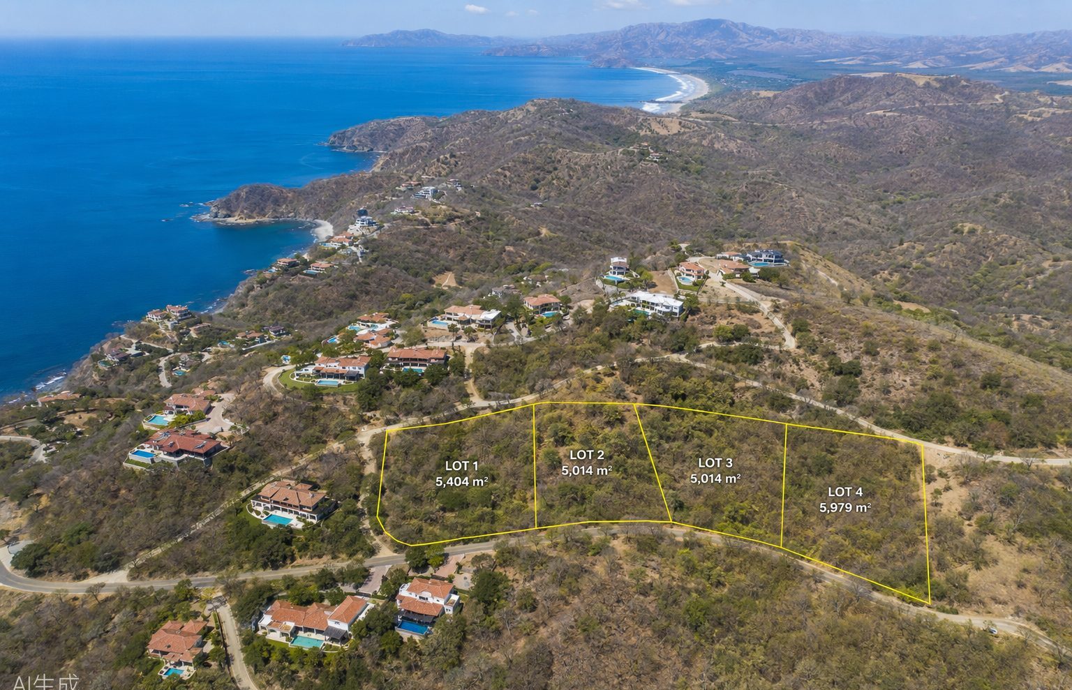
Costa Rica's most desirable land — ocean-view ridges, jungle estates, development parcels — is rarely next to a paved road. Buyers who tour from the air make faster, better decisions. Here's why aerial property tours have become the secret weapon of serious investors and real estate professionals.
See Five Properties Before Lunch
By road, viewing two remote properties in Guanacaste or the southern zone can consume an entire day. By helicopter, the same circuit takes 90 minutes — including low passes over each parcel, hover time for photos, and landings where terrain permits. Agents regularly book us to show international clients an entire portfolio in a single morning.
Understand What Photos Can't Show You
- True topography. Listing photos flatten everything. From the air you see slope, drainage, buildable plateaus and the land's relationship to the coastline at a glance.
- Access and infrastructure. Where are the roads? The neighbors? The nearest power lines? Aerial context answers questions that site visits raise.
- The view you're actually buying. "Ocean view" means many things. From 500 feet you see the exact view corridor from a future build site — before you commit.
- Boundary reality. Fences, encroachments, rivers and protected zones are obvious from above.
Who Books Property Tours
Buyers and investors evaluating land or estates; developers surveying sites and presenting projects to partners; real estate agents who want to close serious international clients in a single visit; and architects and engineers who need aerial site context before design work begins.
How a Tour Works
Send us the property locations (coordinates or pins) and your priorities. Our team plans the most efficient circuit, advises on landing options at each site, and matches the aircraft to your group — the Robinson R66 for up to four, the Airbus H125 or Bell 407 for larger parties with camera equipment. Your pilot flies slow, low orbits over each property and can hover for photography or video. Many clients record the entire flight.
Practical Tips
- Bring a survey map or lot plan for each property — comparing paper to terrain from the air is remarkably productive.
- Morning flights offer the clearest coastal visibility in most regions.
- Combine with ground visits: fly the circuit first, shortlist from the air, then drive only to the finalists. It cuts weeks off the buying process.
- Agents: ask about our multi-client circuit pricing — one aircraft, several listings, several buyers.
The Bottom Line
Land in Costa Rica is a significant investment. A property tour flight costs a fraction of one percent of a typical purchase and routinely saves buyers from expensive mistakes — or reveals the one parcel everyone else drove past. Send us your shortlist and we'll plan the circuit.